MGASHGARI
Application Programmer · Mecca, Saudi Arabia

Mohammed
Gashgari

I build web systems that turn complex operations into clear, reliable tools — workflow platforms, GIS & mapping apps, and automation that handles a season’s worth of work without a single lost file.

MAKKAH AL-MUKARRAMAH
// PROFILE
ROLE  Application Programmer
FOCUS Web · GIS · Automation
BASE  Mecca, Saudi Arabia
DEGREE BSc Computer Science

Computer Science graduate from Taif University, now an application programmer at an engineering office. I focus on building web systems, mapping and spatial-data tools, and automating the repetitive tasks in engineering operations.

Known for precision, attention to detail, and building results-driven solutions that hold up under a deadline — the kind of reliability that high-stakes operations demand.

01

Capabilities

Web & Backend

  • PHP
  • MySQL (PDO)
  • JavaScript
  • HTML · CSS

GIS & Mapping

  • ArcGIS JS API 4.x
  • Spatial data
  • Web mapping

Automation

  • AutoLISP (AutoCAD)
  • Workflow tooling
  • Python
  • Data pipelines

Foundations

  • CCNA 200-301
  • ITIL 4 Foundation
  • Networking
  • IT service mgmt
02

Selected work

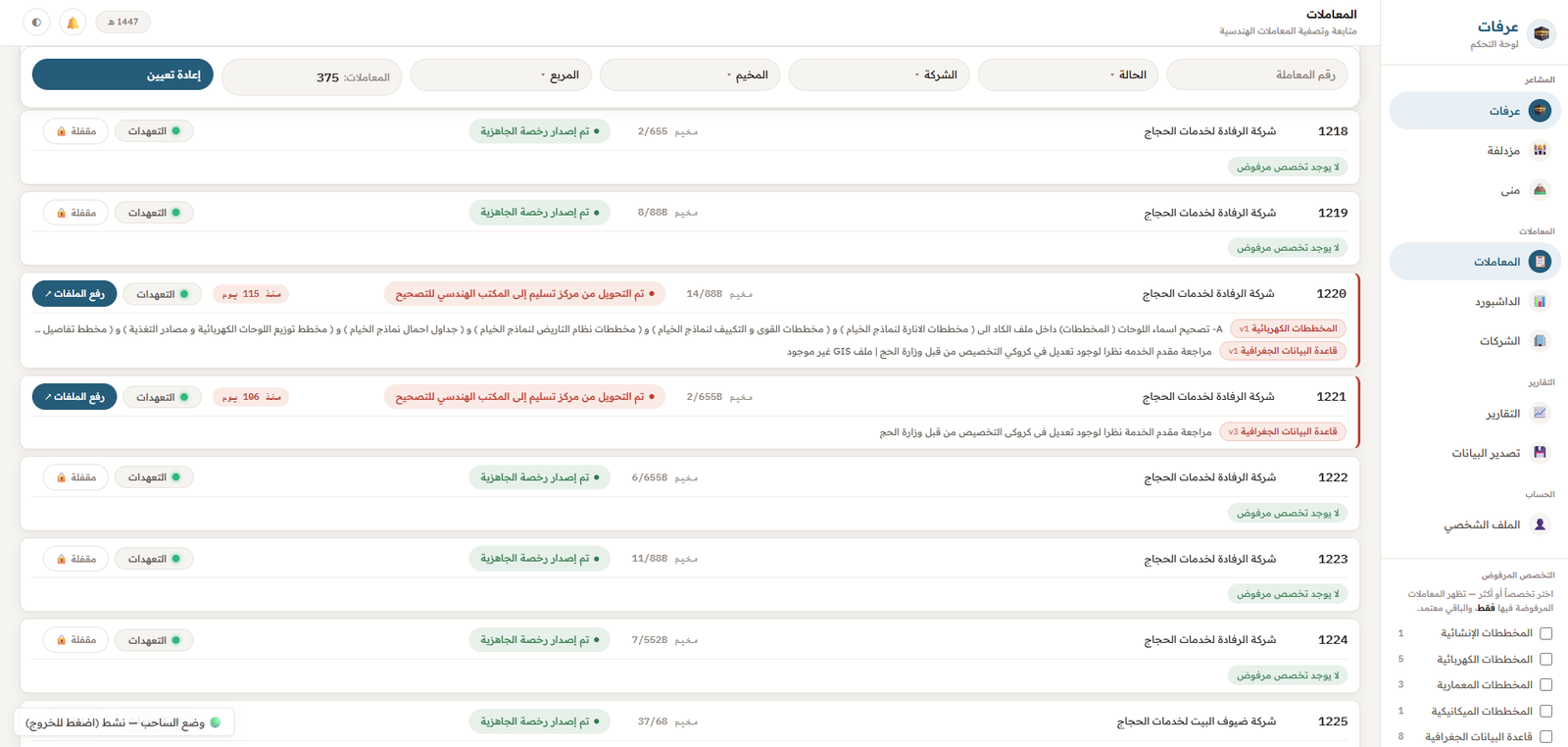
Hajj Sites Submission & OCR Automation Suite 2 ◉ P-01
Web Platform · AI/OCR

Hajj Sites Submission & OCR Automation Suite

A suite of web tools that integrate with a national engineering-submission platform to handle multi-site file submissions across disciplines — architectural, structural, electrical, mechanical, surveying, and GIS. Includes an AI-powered OCR flow that reads engineering quantity tables from an image and auto-registers the values through a secured PHP proxy, with a MySQL backend logging submissions and extracted quantities. Built in vanilla JavaScript with a hardened PHP/MySQL backend and JWT-based API authentication.

JavaScript PHP MySQL OCR / AI REST APIs JWT
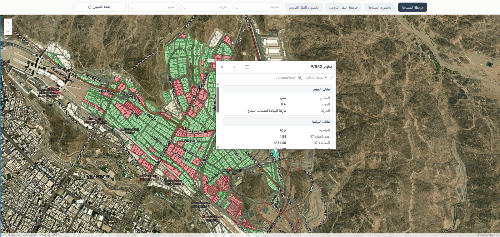
Interactive GIS Mapping Platform 2 ◉ P-02
GIS / Web

Interactive GIS Mapping Platform

Interactive web map built with the ArcGIS JS API that parses data from Excel files and renders it as labeled points for clear spatial reference. Integrated secured (private) feature layers into a personal web platform, managing authentication and layer access to surface location-based data directly on the site.

ArcGIS JS API JavaScript php Excel
03

Experience | credentials

Experience

JUN 2026 — PRESENT
Application Programmer
Eng. Samir Abu Ghalyah Office — Mecca

Built web interfaces to organize and automate the office's internal operations. Ran a hands-on functional and usability review of a web platform, documenting each finding in a structured, type-categorized report to support the development team.

Education | certifications

2026
BSc, Computer Science
Taif University — College of Computers & IT
JAN 2026
Cisco CCNA 200-301
Courslia · 90 hours
JAN 2026
ITIL 4 Foundation
Courslia · 20 hours
contact_eyebrow

Get in touch

Open to work on web systems, GIS applications, and engineering automation. Send a message below or reach me directly.

LocationMecca, Saudi Arabia